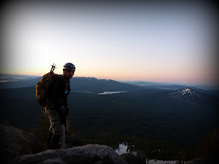
| Redemption! |
 |
| At the trail head |
The trail was clearly marked until you split away from the PCT. We had to do some map/compass navigating but mostly just kept the ridge in view. Someone had laid out some markers on the trees but more often than not we would lose sight of them. A huge storm must have rolled through at some point this winter because there were trees down everywhere. This of course just made the bushwhacking more fun.
 |
| Camp at 7200' |
We watched the shadow of McLoughlin get bigger against the trees. Darkness descended on the valley around us, while Shasta still had the sun beaming on it. We had perfect cellular coverage at this point, mostly due to having a direct line of sight to Four Mile Lake/Klamath Falls.
 The alarm went off at 3:30am and we were leaving camp, head lamped, around 4am. The temperature only dropped to 37degrees but the snow was nice and crunchy. Within 10 minutes we switched from trekking poles to ice-axe and crampons. The ridge was getting steeper and switching out made life a lot easier. We were able to climb straight up the ridge with no problems. Occasionally we would see the official trail but mostly we were zigzagging around rocks and trees.
Before the last 700' or so of elevation, we noticed some nice boot prints from the day prior. These made for good steps the rest of the way up the steepest portion of the climb.
I felt really good during this portion. Our packs were light, I would say under 20lbs, which helped I am sure. I made extra emphasis to walk correctly with my ice axe and was implementing the "Whittaker Wheeze" as to not run out of breath.
I was actually somewhat surprised when I reached the top. I was expecting there to be "more" of the mountain left. I wasn't complaining though. I made my way around to the true summit accomplished and excited. We summited at exactly 7am, which is usually when I would be clocking in for work. Let's just say I was much happier to be on top of Southern Oregon's tallest peak!
Everything went relatively smooth on this trip. I honestly can't think of a single thing I would do differently (other than wrap my feet). All of my gear worked perfectly the way I wanted it too.
Final Stats:
Summit: Yes
Elevation Gain: ~4000'
Round Trip Distance: 10.5 miles
Round Trip Time: 23hours (This includes overnight camp)

No comments:
Post a Comment