One of two Chemeketan climbs I did in 2012. This Mt. Washington climb was led by Mike Niemeyer. We left the Big Lake campground around 7am. It was a beautiful clear summer day. Started out with sunscreen on. Being able to see the summit of Mt. Washington was both exciting and daunting at the same time.
We stayed on the south side of the lake and made our way through the freshly burnt areas until we reached the PCT. Once on the PCT we made our way to the cairn indicating the climbers trail. We headed east up the climber's trail which was pretty well maintained. There was only a few spots where downed trees led to new paths. Once we reached the North Ridge some of our team stashed their trekking poles. We refueled and made our way up the ridge.
Right around this time I had come to learn that the BUTT of my pants was completely ripped. Luckily the mesh inner lining and my boxers prevented permanent blinding of my fellow climbers. This was unfortunate but not enough to stop me from wanting to summit. :)
Looking at the Summit Block on Mt. Washington
Once we got to the notch we left our packs, put on our helmets and harnesses and carried any gear we would take to the summit and back. We went up the second ramp, which is supposed to be easier. Mike led the climb up and protected the route where he could. Two mindless climbers who had ran past us earlier on the ridge were already rappelling back down over our heads. It was definitely terrifying to hear and see rocks coming down over top of you. Luckily due to the exposure above us the rocks just flew past us.
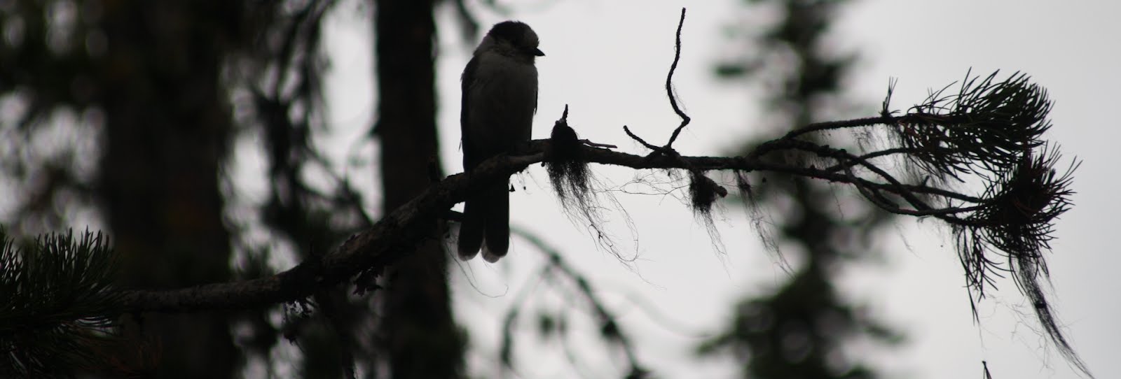
Three Finger Jack and Mt. Jefferson from Mt. Washington
The crux of the climb was about 50' up the ramp where there is a chimney. We had heard advice to "not get sucked into the chimney". There wasn't an easy way up if you get in too far so it took me a second but I stood back and looked at what needed to be done and did it.
Mike protected 3 pitches to the top, which I am sure was conservative, but it was some nice insurance. I was more worried about kicking rocks down on my fellow climbers then I was about falling. Shortly there after we reached the summit. We noticed a fire East of Mt. Hood that had grown quite massive by the time we reached the summit. It started creating it's own thunderhead.
Chemeketan Summit Team
Mason and Mike setting up a rappel
After high fives, and filling out the summit register, we started back down. Mason and Mike set up 3 rappels to get us back down to the notch. The last rappel was the most fun as it was exposed and over-hung a bit. I actually didn't really feel scared, it was a fun experience.
Once we made it safely back to the notch we slogged all the way back to the trailhead. After wading through the dusty PCT and being sun-cooked the people on Big Lake taunted us by playing in the water with their boats. I really wanted to just jump in the water but we were short on time and it was getting late.
This was my first alpine rock climb and I can certainly say it won't be my last.
Final Stats: Summit: Yes Elevation Gain: 3100' Round Trip Distance: 11+ miles Round Trip Time: 12 hours
Broken Top had been on my "list" ever since seeing it while hiking up South Sister in 2011. It was so unique looking that I even posed in a picture halfway up South Sister pointing at Broken Top calling it out. "I WILL BE BACK". Of course at the time I wasn't fully sure how I would manage to climb it, since I was just starting to get into mountaineering/climbing.
View from Cascade Lakes Scenic Highway heading West
We decided on doing an "up and back" of Broken Top, leaving the Salem area really early and being back late. It was a day of extremes for us. We hadn't noticed since we were inside the car, but it was a cool 34 degrees outside at the Green Lakes/Fall Creek trailhead. We weren't expecting this at all and by the time we returned to the car that afternoon it was a very hot 80 degrees.
Sunrise over Broken Top from Green Lakes
The green lakes trail was beautiful, and we bombed through it rather quickly. I think it would be a nice trail to take the family on and overnight camp at Green Lakes. After getting small glimpses of Broken Top from the Trail we were delighted to get this view of the mountain near green lakes just before the turn out to the summit trail.
Northwest ridge of Broken Top
I figured the trail leading up to greenlakes would have warmed my body up enough for the ascent to the ridge, but then I slowed down quite a bit and felt winded. It was a reminder that we were in fact gaining elevation again and couldn't continue the pace we had done on the trail. Reality slapped me hard and I handed over a couple pounds of weight to make my ascent easier. Before long we had acquired the ridge.
The dad helping his kid climb the crux
Making our way up the ridge was fun and exciting. There were a few times where the "path" wasn't obvious and we definitely did some class 3 scrambling to make our way up. After about an hour and a half we came up to the "crux", which is a 10-15' nose of solid rock. Here we encountered a dad with his two sons, and an older gentlemen who had already scrambled his way to the summit. The dad seemed to be a bit in over his head with the kids and so we offered to help. We weren't worried about time and figured it would be better to lend a helping hand then hear a bad story later or worse, have to assist in a rescue. I belayed Mason up the nose and he didn't have time to set protection. For his comfort level it wasn't necessary. Once on top Mason belayed the kids and then the dad up. I followed shortly after.
After the nose climb we traversed along the exposed ramp and over and through the exposed catwalk. The dad decided to clip his kids into his harness (not sure how I feel about this, but I guess it was safer then nothing...unless he slipped of course). At this point there was a really nice exposed class 4 climb up to the summit. This portion was actually the most puckering to me, but it wasn't bad.
At the summit of Broken Top with the Sisters photo bombing us
Down climbing from the summit block
Walking back across the catwalk
Thumbs up!
After a successful summit we down climbed from the block and returned back to the nose. Mason set up a rappel off of a sling. There was a HUGE rock to use as a rap anchor. We let the dad rap down first then we tied the kids in and belayed them down. I rapped down and Mason followed closely behind, stopping for a minute to pose. We gathered up all of our gear and made our way partway down the ridge. We quickly realized it would be MUCH easier to skree ski all the way down the mountain so we did. It was a little nerve racking but I went with the flow and we got down in record time. We refilled our water at green lakes and marched back to the trail head.
Broken Top in the afternoon from Green Lakes after a successful summit
I decided to take advantage of the nice weather and take my son out for a hike. While looking on SummitPost I found this short hike that offered plenty of reward for little effort. The dirt road up features views from Mt. Adams down to Broken Top.
Zack and the snags
While this is a relatively easy hike, it was hard pacing myself to match my sons pace. He isn't nearly as accustomed to trail slogging as I am, especially when I am on flat terrain. Part way up you get into an old burn area with snags and a clearing. This would be a great place for a picnic or even an overnight stay (if you wanted).
Bachelor Mountain Trail sign
After a short while past the clearing you come to a fork in the road. Stay left at the well marked sign, which is trail no. 420. Even though the SummitPost page says the trail is maintained I found myself ducking under branches and trampling over quite a bit of weeds and grass. A few times I had to hold the grass down so Zack could get through it.
Zack on some loose rock on Bachelor Mountain
Having made it through the thicker forest area of the trail we came upon some nice loose rock to scramble over. The path was pretty well maintained but I stayed close to my son since I didn't want him falling.
We had a nice lunch on the summit, albeit a fast one, due to the horseflies that were bothering us. We even found what looked like an old indian petroglyph of a deer near the summit. We left it in hopes that it was real. The way back down was pretty uneventful. Zack started complaining about his legs but we kept on. Stopped for some ice cream in Idahna on the way back home.
Coffin Mountain and Lookout from the Bachelor Mountain trail.
Laying on the summit of Middle Sister catching some sunshine
This was my first official climb with the Chemeketans. After lots of trouble with weather and scheduling earlier this year (cancelling Mt. Hood trips), I was excited to do a club climb. Usually I only climb with groups of 4 or less, so it was a new and welcome experience.
Heading up the snowfields
We left from the Pole Creek Trailhead around 11am. My pack was roughly 45lbs, but I was feeling strong and being in a group made me forget about the weight. The heat was beating down, with it being 70degrees or more. My brand new Mountain Hardware Stretch Bandana was coming in handy. I ended up using it almost the entire duration of the trip for one thing or another.
Almost 2 hours later, and a few breaks in between we made it to the turn off for the climbers trail. After this point we started hitting patches of snow and crossed a few creeks.
Water carves ice and snow
Things started getting really awesome here, scenery wise. With Broken Top to the south and the Three Sisters popping up it started reminding me why we were out there.
We decided to continue on past the normal place to camp at 6900' and instead climb the snow fields until we reached the toe of the Hayden Glacier, closer to 8000'.
Shortly after arriving we set up camp and found a nice pool of water. We decided to boil it just for safety's sake but I am sure it would have been ok to drink on it's own. After boiling water for the following day and storing it in the tent, I made quick work of a delicious Mountain House. We went over tying in for the following morning and also some basic glacier travel etiquette.
Camping at 8000'
The following morning we got up at 3:00am, roped in, and started a slow but steady climb up the Hayden Glacier. With such a light summit pack I never felt like I was working very hard. It was nice and made the trip more enjoyable. I got to turn around and see the sights quite regularly. One amazing site was seeing headlamps on other mountains around us. There was a group going up North Sister and I saw one headlamp turn on on South Sister's summit.
Heading up Hayden Glacier
Crux picture courtesy of Mike Pennington
When we reached the top of Hayden Glacier, we un-roped and took off our ice-axes/crampons. We scrambled up some poor scree/rocks until we were at the base of the crux move. The crux is a ~40degree pitch that most people bang in protection on. Being that it was a Chemeketan climb, there was no way we were doing without a few snow pickets. There were nice footsteps all the way up the pitch and quite honestly I felt safer here then some parts of my Mt. McLoughlin climb. Perhaps it was just knowing we were clipped into a rope, or maybe it was because of the club atmosphere.
Washington, Three Finger Jack, and Mt. Jefferson
Once we reached the top of the crux we unroped and did another scree climb til we reached the summit. We got out sweet summit photos and proceeded back down to camp. There was a group of Mazama's heading up as we were heading back down. After breaking down camp I threw my rain gear on and had a fun glissade, which seemed to save lots of time. After we got off the snow it was a long slog back to camp. I really enjoyed this trip and wish to be on future Chemeketan climbs.
Chemeketan team summit photo!
Final Stats:
Summit: Yes Elevation Gain: 4747' Round Trip Distance: 12+ miles Round Trip Time: 24+ hours FULL PHOTO ALBUM
Henline Mt. in the Opal Creek Wilderness is a pretty straight forward hike. Unfortunately, when you attempt in in mid-April during unusual snowfall the "straight forward hike" becomes much more difficult. Last April we attempted to reach the summit only to fall short.
Looking West back towards Salem
Fast forward to July and now the trail and the summit are completely snow free. We parked at the trailhead and left the car around 6:45am. At the Henline Mountain Trailhead 3352 you must fill out a free Wilderness Permit. I have seen reports (after we hiked) that you also need a Northwest Forest Pass, but we didn't have one in my car and I didn't get a ticket.
You start gaining elevation pretty quickly heading up the trail. We were in 60+ degree weather so we started out in shorts/shirt and opted out on gaiters. There are a few small rock outcroppings that you can get great views towards the west from. There are also some loose rock slide areas that help break up the trail nicely. When you reach the old lookout tower be sure to soak in the sights and also eyeball the true summit.
After getting hydrated and eating a small snack we continued up towards the summit. This is not an official trail but honestly it would be hard not to follow the stomped down trail in the bear grass and dirt. After seeing some bear scat and lots of trees with bark scraped off I was actually starting to worry about bears.
Jefferson stands above
We reached the summit (2700' higher than the trailhead). Since the summit isn't above timberline we didn't feel the need for any great poses. We trotted our way back down the mountain and made it before it got too hot. I still sweat a ton and almost finished off the 2.5L I had brought.
Overall this was a great conditioning hike and it felt great to be outdoors again. My next report will hopefully be about my summit of the Middle Sister with the Chemeketans.
Here is my GPS output for Henline Mt
Final Stats:
Summit: Yes
Elevation Gain: ~2700'
Round Trip Distance: 7.6 miles
Round Trip Time: 3.75hours
A feeling of redemption, followed by a wolf cry, was what came out as soon as I reached the summit of Mt. McLoughlin. After a failed attempt last March due to deep snow and lack of snowshoes, it felt great conquering the mountain. Sure, it isn't the highest peak in Oregon, or even in the Top 5, but it is still a peak, and it is now on the bagged list.
At the trail head
Seeing a window of opportunity in the weather, we decided we had better strike while we could. This year has been pretty miserable with the weather always seeming to get in the way of our peak dreams. Regardless, we made the 4 hour drive down to the Sky Lakes Wilderness area. The unmaintained road to the McLoughlin trail head was interesting. Huge ruts, meant we were driving slow and careful not to bottom out the car. I would recommend being in a high clearance vehicle for the drive up.
The trail was clearly marked until you split away from the PCT. We had to do some map/compass navigating but mostly just kept the ridge in view. Someone had laid out some markers on the trees but more often than not we would lose sight of them. A huge storm must have rolled through at some point this winter because there were trees down everywhere. This of course just made the bushwhacking more fun.
Camp at 7200'
We decided to make camp right around the 7200' level. We found a place in the snow that was somewhat flat, but more importantly we had an unimpeded view of Mt. Shasta!
We watched the shadow of McLoughlin get bigger against the trees. Darkness descended on the valley around us, while Shasta still had the sun beaming on it. We had perfect cellular coverage at this point, mostly due to having a direct line of sight to Four Mile Lake/Klamath Falls.
The alarm went off at 3:30am and we were leaving camp, head lamped, around 4am. The temperature only dropped to 37degrees but the snow was nice and crunchy. Within 10 minutes we switched from trekking poles to ice-axe and crampons. The ridge was getting steeper and switching out made life a lot easier. We were able to climb straight up the ridge with no problems. Occasionally we would see the official trail but mostly we were zigzagging around rocks and trees.
Before the last 700' or so of elevation, we noticed some nice boot prints from the day prior. These made for good steps the rest of the way up the steepest portion of the climb.
I felt really good during this portion. Our packs were light, I would say under 20lbs, which helped I am sure. I made extra emphasis to walk correctly with my ice axe and was implementing the "Whittaker Wheeze" as to not run out of breath.
I was actually somewhat surprised when I reached the top. I was expecting there to be "more" of the mountain left. I wasn't complaining though. I made my way around to the true summit accomplished and excited. We summited at exactly 7am, which is usually when I would be clocking in for work. Let's just say I was much happier to be on top of Southern Oregon's tallest peak!
Everything went relatively smooth on this trip. I honestly can't think of a single thing I would do differently (other than wrap my feet). All of my gear worked perfectly the way I wanted it too.
Final Stats: Summit: Yes Elevation Gain: ~4000' Round Trip Distance: 10.5 miles Round Trip Time: 23hours (This includes overnight camp)
Here is a look at the climbs I would like to do this year. 3-4 of my trips are scheduled to be with my climbing club, the Chemeketans. The other trips will most likely be with only 2-3 people.
This photo was taken by other climbers and sent to us. I am on the left.
Map of climbing routes on St. Helens
After an unusually mild winter up til that point, we looked at the weather on a Friday and I jokingly made a comment that we should try to summit St. Helens the following Monday. The thing about saying something like that to another mountaineer with summit fever is that they will share the same crazy idea. After settling things with work and our families we decided to start trip planning.
The first aspect to think about was gear. I had not yet done a winter or potentially icy summit yet. I had already purchased my
Black Diamond Raven Pro Ice Axe Silver, 70cm however and was more than ready to use it.
Next and bigger aspect would be Boots/Crampons. I decided to visit my local REI and rent some universal crampons but they don't do that. REI made me rent a pair of boots and semi-auto crampons
Climber Registration at Lone Fir
Monday the 12th rolls around and I sneak out of the house around 3:00am in order for us to get an early start. Before too long we are already near Cougar, WA where we stop a location I had visited less than 6 months earlier. The Lone Fir Resort. Of course at 5:30ish in the AM there was no one around but us. So we wiped the frost off of the climber register handbook and wrote down our party info in case we went missing.
Looking up from the ski trails
Within a half our later we park and get ready to depart the Marble Mountain Sno Park. Here we are at a whopping 2700' of elevation. Which is about 1000' lower than the Climber's Bivouac. As we make our way with headlamps up the ski-trails I start to notice that my heavy rental boots aren't feeling so good on my right heel. After only a mile and a half into the trip, I decided to access what is going on with my heel. I pull off my right boot only to find that the inner liner of the rental boot was completely gone. (Because I have an REI Membership they refunded me the entire cost of my rental) I used some of Mason's moleskin to patch up around where the blister was forming and decided to keep going. Minutes later I realize that I had left a glove somewhere on the trail. (Lesson learned, shortly after this trip I purchased the
REI Switchback Gloves )
If it sounds like everything was going wrong, well it was. I of course didn't have spare gloves so I opted for a wool sock, which is really not a good substitute at all I found out. As we get above the treeline my spirit is lifted again. It is truly a beautiful day and we can see forever.
Looking south
There I am, far far away contemplating life and being miserable
Now we worked our way slowly up the mountain. All my hard training and conditioning for this climb would have paid off had I done any. After a lazy football season full of enough chips and dip to feed an army, I was much more out of shape than on my previous climbs that year. As I put one foot in front of the other my mind was breaking. Mason was getting a ways ahead of me and I had to dig deep and ask myself if I thought I could actually make the summit. I actually wasn't sure if I could or not. It seemed like miles away and the mountain was only getting steeper. This added with other annoyances made this trip the most difficult I have done thus far.
But alas, we reached the top and traversed west along the ridge to the top. Our moment of glory at the top was out-weighed by the need to get back to the car before dark. Of course, on par with how the day was going, we couldn't glissade like we had hoped due to the snow being too hard/icy. So we down-climbed the entire thing and got back to the sno-park just as it was getting dark outside. We ran into a sheriff heading up the road as we were going down. I am assuming he was checking to see if our car was still there. I went to bed with what felt like a fever but woke up perfectly fine.